Agriculture
Satellite Crop Monitoring That Survives Clouds: Beating Revisit Gaps with Harmonization and SAR
One of the bottlenecks in satellite crop monitoring is not sensors or indices, it is clouds. Sentinel-2’s 5-day revisit is a brochure number; under cloud your effective revisit can stretch to weeks, exactly during the rainy stretches when crops change fastest. An operational pipeline is one engineered around that gap: harmonized multi-sensor optical imagery, radar for continuity, and a rule for when to pay for tasked imagery.
Key takeaways:
- Design for effective revisit, not the brochure number. Global cloud cover averages roughly two-thirds of Earth’s surface at any given time (per the International Satellite Cloud Climatology Project, ISCCP), so Sentinel-2’s nominal 5-day pass collapses to weeks of usable gaps in the wet season.
- Assemble a sensor stack, not a single source: free Sentinel-2 as the workhorse, Landsat for the archive, paid Planet imagery (PlanetScope and SkySat) to increases the probability of obtaining a cloud-free observation, and Sentinel-1 Synthetic Aperture Radar (SAR) for all-weather continuity.
- Gate the pipeline on quality: a minimum clear-pixel fraction, a cloud-fraction cap, and an escalation rule that automatically tasks paid imagery when a high-value field goes unobserved.
- When optical is clouded out for weeks, SAR is the fallback, maintaining temporal continuity and not a missing-data apology.
This is for Earth-observation and agriculture engineers building a monitoring service, not running a one-off Normalized Difference Vegetation Index (NDVI) map.
The number that breaks naive satellite crop monitoring
Clouds cover roughly two-thirds of Earth at any given moment (about 66 to 67% by the long-running ISCCP record). That is the single fact most “how to monitor crops with satellites” guides omit, and it quietly invalidates their advice. Sentinel-2’s nominal 5-day constellation revisit at the equator (European Space Agency, ESA, and Copernicus) assumes every pass is usable. It is not. In a cloudy region or a monsoon season, you might get a handful of clear scenes across an entire growth stage.
So separate two numbers in your head:
- Theoretical revisit: how often the satellite passes over. Sentinel-2: ~5 days.
- Effective revisit: how often you get a cloud-free observation of your field. Often much worse, and worst exactly when you need it.
Every technique below exists to shrink the gap between those two numbers. Design for effective revisit, report effective revisit, and never promise a customer the brochure figure.
The sensor stack you actually need
No single sensor delivers reliable, frequent, field-scale monitoring. You assemble a stack, free workhorse first, paid and radar to fill holes.
| Sensor | Resolution | Revisit | Cost | Cloud penetration |
|---|---|---|---|---|
| Sentinel-2 | 10 m (4 bands), 20 m, 60 m | ~5 days | Free | None (optical) |
| Landsat 8/9 | 30 m (15 m pan) | 8 to 16 days | Free | None (optical) |
| PlanetScope | ~3 m, 8 bands | ~Daily | Paid | None (optical) |
| SkySat | ~0.5 m | Sub-daily, tasked | Paid | None (optical) |
| Sentinel-1 (SAR) | ~5 to 20 m | ~6 to 12 days | Free | All-weather |
Sentinel-2 is the backbone: 13 bands, four at 10 m (blue, green, red, near-infrared), a 290 km swath, and since September 2024 a third satellite (Sentinel-2C) reinforcing the constellation (ESA). PlanetScope adds near-daily coverage at about 3 m across 8 bands, and SkySat offers roughly 0.5 m tasked imagery for the moments a free pass cannot resolve (Planet). Sentinel-1 is the one that does not care about weather: C-band SAR images day or night, through cloud and in most weather conditions, which makes it the continuity layer when optical goes dark for weeks.
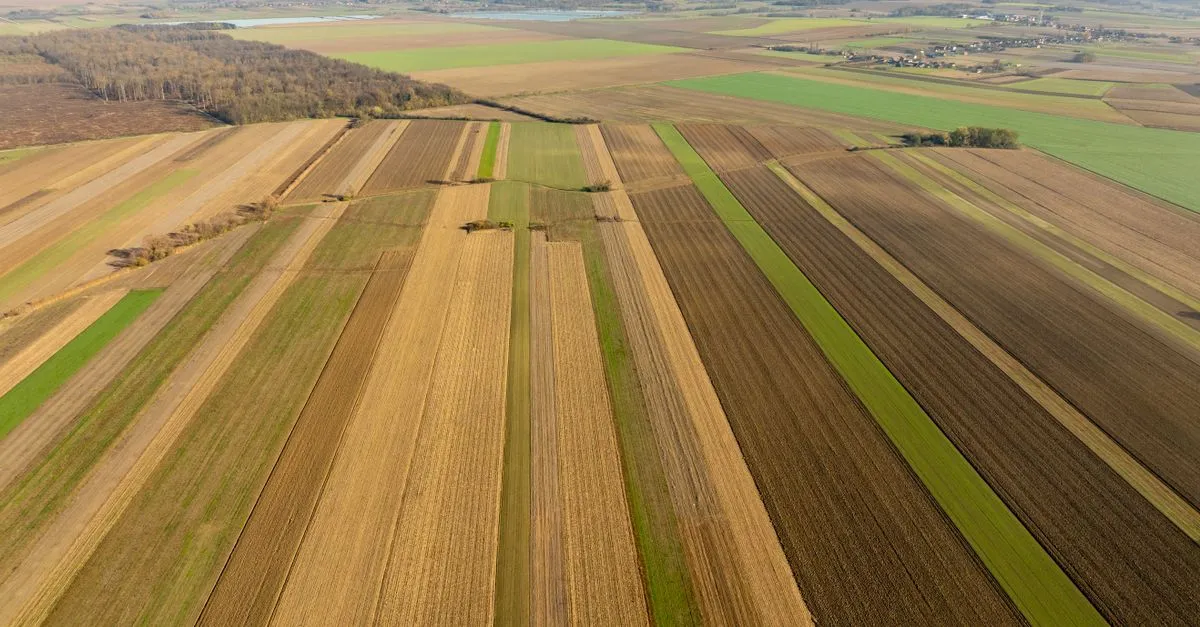
 The real adversary of optical crop monitoring. Clouds obscure roughly two-thirds of Earth at any moment, so your effective revisit is far worse than the brochure’s. Photo by eddie chuachoonhui on Pexels.
The index toolbox, briefly
You know these; the point is matching one to a question, not defining them:
- NDVI for biomass and general vigor early, with the saturation caveat in closed canopies.
- EVI/EVI2 (Enhanced Vegetation Index, and its two-band variant) when NDVI saturates or atmospheric and soil-background effects dominate.
- NDRE (Normalized Difference Red Edge) for chlorophyll and nitrogen in mid-to-late canopy, where NDVI flattens.
- GNDVI (Green Normalized Difference Vegetation Index) as a green-band alternative for nitrogen sensitivity.
- NDMI/NDWI (Normalized Difference Moisture Index and Water Index) for canopy and soil moisture, the first place drought stress shows.
Anchor a workflow on NDVI plus one moisture index and one red-edge index, and you cover most in-season questions without drowning in indices.
Harmonizing Sentinel-2 with Planet and Landsat
Here is the part that separates a pipeline from a script: you cannot just stack scenes from different sensors. Sentinel-2, Landsat and Planet differ in spectral response, view and sun geometry, resolution and georeferencing. Drop them on the same time series raw and your index “trends” will be sensor artifacts, not crop change.
Harmonization fixes that, and the reference standard is NASA’s HLS. It takes the Landsat 8/9 Operational Land Imager (OLI) and the Sentinel-2 MultiSpectral Instrument (MSI) and produces a single 30 m, analysis-ready surface-reflectance product: atmospherically corrected, geometrically co-registered to a common grid, with BRDF normalization and bandpass adjustment so a pixel means the same thing regardless of which satellite saw it (NASA Earthdata). The payoff is revisit: HLS reports a combined median revisit around 1.6 days (four satellites, 2022), improving toward ~1.4 days in 2025 with five satellites. That is what multi-sensor harmonization buys you, a usable cadence no single mission can match.
The four things harmonization has to get right, whether you use HLS or roll your own to fold in Planet:
- Surface reflectance, not top-of-atmosphere. Use Sentinel-2 Level-2A (L2A), not Level-1C (L1C), so atmospheric effects are removed and scenes are comparable over time.
- Bandpass adjustment. A Sentinel-2 red band and a Landsat red band are not identical; small linear corrections align them.
- BRDF normalization. Reflectance depends on sun and view angle; normalize to a common geometry or your cross-sensor differences are just illumination.
- Co-registration. Sub-pixel alignment to a common grid, or your time series smears across field boundaries.
Planet sits outside HLS, so folding PlanetScope in means doing this yourself: cross-calibrating Planet’s bands to the Sentinel-2/Landsat reference and co-registering to the same grid. It is work, but it is the difference between “we have Planet too” and a time series you can actually trust.
An operational pipeline that survives gaps
Assemble it as a chain, each stage earning its place:
- Ingest Sentinel-2 L2A (plus Landsat, plus Planet if you have it) for the area of interest.
- Cloud and shadow mask every scene, then compute a clear-pixel fraction per field. This is your gate.
- Harmonize across sensors (HLS-style surface reflectance, bandpass, BRDF, co-registration).
- Gap-fill and composite. Temporal compositing and interpolation across the harmonized stack to produce a continuous index series instead of a scatter of clear days.
- Fuse SAR for continuity. When optical is blanked for an extended period, lean on Sentinel-1 backscatter to keep a structure signal alive.
- Compute indices and detect anomalies, with alerts keyed to change against the field’s own history, not an absolute threshold.
Then add the quality-assurance (QA) rules that make it operational rather than aspirational. This is also where standards and frameworks like GEOGLAM (Group on Earth Observations Global Agricultural Monitoring), the monitoring initiative, set the bar for what “operational” means: consistent, repeatable monitoring you can stand behind, not a clear-sky highlight reel.
What about when it is cloudy for weeks?
You stop relying on optical alone. Three moves, in order of effort: composite the harmonized optical stack so the few clear pixels you did get are used well; bring in Sentinel-1 SAR for an all-weather structure signal through the cloud; and, for fields where the decision cannot wait, task commercial imagery. The mistake is treating a cloud gap as missing data to apologize for. In an engineered pipeline it is a handled case with a defined fallback.
Frequently asked questions
How often do crop-monitoring satellites take new images of my field?
Sentinel-2 passes roughly every 5 days at the equator with its two-to-three satellite constellation, and more often at higher latitudes. But that is the theoretical revisit. Clouds mean your effective, cloud-free revisit is often much longer, sometimes weeks in wet seasons. Harmonizing Landsat and Sentinel-2 (HLS) or adding daily Planet imagery shortens the usable interval.
What happens to satellite crop monitoring when it is cloudy?
Optical sensors cannot see the ground through cloud, so those scenes are masked out and you get a data gap. Since clouds cover roughly two-thirds of Earth at any time, gaps are the normal case, not the exception. Operational pipelines handle them with temporal compositing, multi-sensor harmonization, radar, and tasked imagery rather than simply waiting.
Can you monitor crops through clouds?
Yes, with radar. Synthetic aperture radar such as Sentinel-1 uses microwaves that pass through cloud, smoke and rain, and images day or night. It measures canopy structure and water content rather than pigment, so it does not replace optical indices, but it keeps a continuous signal alive when optical is blanked out, which is why it is the backbone of all-weather monitoring.
What is the difference between Sentinel-2 Level-1C and Level-2A for crop monitoring?
Level-1C is top-of-atmosphere reflectance; Level-2A is atmospherically corrected surface reflectance with a scene classification and cloud mask. For monitoring a field over time you want Level-2A, because only surface reflectance is comparable across dates and sensors. Using L1C means atmospheric variation contaminates your index trends.
Which is better for crop monitoring: free Sentinel-2 or paid Planet imagery?
They serve different roles. Sentinel-2 is free, 10 m, and good for routine whole-field monitoring on a roughly 5-day cadence. PlanetScope is paid, about 3 m, and near-daily, which matters when clouds break the Sentinel-2 cadence or you need to resolve sub-field detail. The cost-effective pattern is Sentinel-2 by default, Planet tasked on demand when revisit or resolution falls short.
What resolution do you need to monitor crops at the field level?
For whole-field trends and management zones, 10 to 30 m (Sentinel-2, Landsat) is usually sufficient. For sub-field features, narrow stress stripes, small weed or disease patches, you need 3 m or finer (PlanetScope, SkySat or drones), because coarser pixels average those features into the background. Match resolution to the smallest feature you intend to act on.
How do you harmonize Sentinel-2 with Landsat or Planet?
You convert all scenes to surface reflectance, apply bandpass adjustments so equivalent bands match, normalize for sun and view angle (BRDF), and co-register to a common grid. NASA’s HLS product does this for Landsat and Sentinel-2 at 30 m; folding in Planet means cross-calibrating its bands to that reference yourself. Without harmonization, multi-sensor trends are artifacts.
Which vegetation index is best for detecting crop water stress early?
Moisture-sensitive indices such as NDMI or NDWI, which use shortwave-infrared or green and near-infrared bands, respond to canopy and soil water before visible wilting appears. They are a better early-drought signal than NDVI, which tracks greenness and lags water stress. Pair a moisture index with a red-edge index to separate water stress from nitrogen stress.
Sources and further reading
- ESA/Copernicus, Sentinel-2 mission specifications and revisit (SentiWiki)
- NASA Earthdata, Harmonized Landsat Sentinel-2 (HLS) project
- Planet, PlanetScope and SkySat imagery products
- ESA Knowledge Hub, Cloud cover and Sentinel-2 observation availability
- GEOGLAM, Group on Earth Observations Global Agricultural Monitoring
Revisit numbers, satellite counts and product specifications are accurate as of June 2026 and change as constellations evolve; effective revisit depends on local cloud climatology. Verify current figures against the mission sources before quoting them.