Automotive & Mobility
Satellite-assisted Lane-Level Navigation: The Sensor Fusion That Knows Which Lane You're In
Satellite-assisted Lane-level navigation needs to know which of several 3 to 4 m lanes you occupy, which means resolving position to better than about 1.5 m, and under a meter to act on it. Standalone Global Navigation Satellite System (GNSS), sometimes at several meters of error, cannot reliably do that. You get there by fusing corrected GNSS, an Inertial Measurement Unit (IMU), wheel odometry and a High-Definition map (HD map), so the stack holds lane accuracy even when the sky disappears.
Key takeaways:
- Accuracy class: lane-level work demands a minimum of sub-1.5 m (realistically sub-meter) horizontal error.
- Corrections set the accuracy: PPP-RTK delivers wide-area, base-free centimeter-to-decimeter positioning with around 30 to 100 s convergence, where plain Real-Time Kinematic (RTK) is hard to scale and classic PPP converges too slowly.
- The IMU buys continuity: dead reckoning on an inertial unit plus wheel odometry holds position through tunnels and canyons, and drift is dominated by IMU grade.
- Tight coupling wins in cities: feeding raw pseudoranges into the filter keeps a usable solution with fewer than four satellites, exactly where loosely coupled fusion goes open-loop.
- The HD map keeps the lane: map-matching against known lane geometry resets lateral drift, turning a drifting dead-reckoned position back into a lane-correct one.
How accurate does lane-level navigation actually need to be?
A highway lane is roughly 3 to 4 m wide. Advanced automated driving functions increasingly target decimeter-level lateral accuracy, with around 20 cm often cited for robust lane-centering performance.
The accuracy layer: PPP-RTK, HAS with realistic Ambiguity Resolution and why RTK alone does not scale
Corrections transform meter-level GNSS positioning into centimeter- to decimeter-level accuracy. The three main correction approaches are not interchangeable, particularly for a moving vehicle fleet.
-
RTK (Real-Time Kinematic) provides 2-8 cm accuracy but requires access to a nearby base station (or reference station network) within tens of kilometers, along with a low-latency correction link. It is an excellent solution for survey rovers but is challenging to scale to millions of vehicles operating across an entire continent.
-
Precise Point Positioning (PPP) offers global coverage without requiring a local base station. However, conventional PPP suffers from long convergence times, typically several to tens of minutes, which limits its usefulness for vehicles that frequently start, stop, or temporarily lose GNSS reception. According to the European Union Agency for the Space Programme (EUSPA), the Galileo High Accuracy Service (HAS) targets better than 20 cm horizontal accuracy, with Service Level 1 achieving global convergence in under 300 s and Service Level 2 reducing convergence to around 100 s in Europe by incorporating atmospheric corrections. While Level 2 would bring convergence times into a practically usable range for lane-level navigation, it has yet to be implemented (state 2026) and later validated in real-world deployments.
-
PPP-RTK combines the strengths of both approaches. It provides the wide-area, base-free coverage of PPP while resolving integer ambiguities, as in RTK, and incorporating atmospheric corrections. As a result, convergence times are reduced to approximately 100 s or less, while achieving centimeter-level accuracy comparable to RTK. Like PPP, PPP-RTK corrections are broadcast using State Space Representation (SSR), which scales much more efficiently to large vehicle fleets than transmitting raw observations from reference stations.
The continuity layer: IMU dead reckoning through outages
Corrections do nothing in a tunnel. The moment GNSS is blocked, by a tunnel, an underpass, a parking structure or an urban canyon, the position has to come from somewhere else, and that somewhere is dead reckoning on an inertial measurement unit, propagating the last known state forward from accelerometer and gyro data.
The catch is drift, and drift is entirely a function of IMU grade: Automotive MEMS INS integrated with wheel odometry can often maintain lane-level positioning for short GNSS outages, while navigation-grade systems exhibit substantially lower drift over extended outages. Therefor, a ring laser INS outperforms an automotive MEMS INS by orders of magnitude in stability, but also in pricing.
This is why production parts like u-blox’s dead-reckoning receivers pair GNSS with integrated inertial sensors to hold lane-accurate, decimeter-level positioning through tunnels and garages. The IMU does not improve your clear-sky accuracy; it buys you time when the sky is gone.
Loosely vs tightly coupled GNSS/INS
This is the distinction the surface-level guides skip, and it decides how your stack behaves exactly when it matters: in the urban canyon with four satellites and heavy multipath.
- Loosely coupled fusion combines in the position domain: the GNSS receiver computes its own position/velocity, and the filter blends that with the INS solution. Simple, modular, but it needs the receiver to produce a fix at all. Drop below four usable satellites and the GNSS input vanishes, leaving the INS to drift alone.
- Tightly coupled fusion combines in the measurement domain: raw pseudoranges and carrier phases feed the filter directly, alongside the IMU. The crucial consequence is that even two or three satellites still contribute information, so the filter keeps constraining the solution in a canyon where a loosely coupled system would have already gone open-loop.
- Ultra-tight (deep) coupling closes the loop further, feeding the navigation solution back into the receiver’s tracking loops to hold weak signals. Maximum robustness, maximum complexity, and usually a custom receiver.
| Coupling | What it fuses | Useful with < 4 satellites | Complexity |
|---|---|---|---|
| Loose | GNSS position/velocity + INS | No (needs a full fix) | Low |
| Tight | Raw pseudorange/carrier phase + INS | Yes (each satellite still helps) | Medium |
| Ultra-tight | Fed back into tracking loops | Yes, plus weak-signal tracking | High |
For lane-level work in real cities, tightly coupled is the practical floor. Loosely coupled is fine on open highway and falls apart precisely where lane-level matters most.
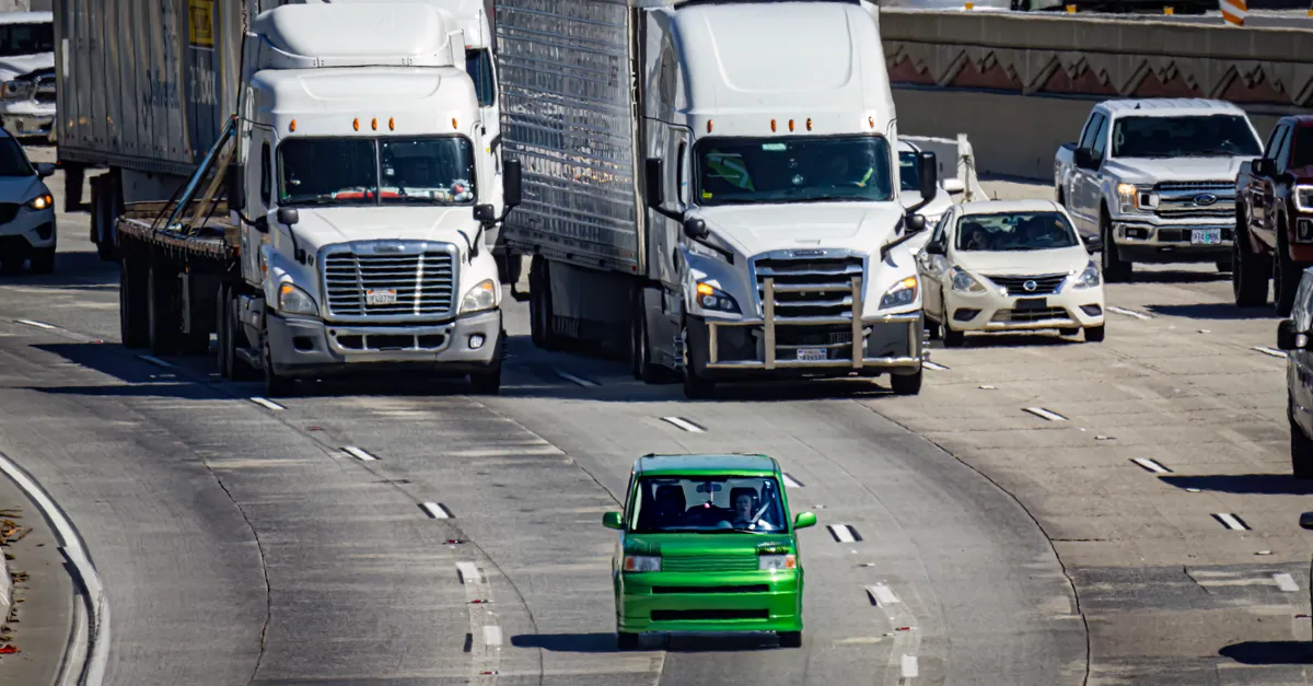
 Map-matching against an HD map is what resets lateral drift after a GNSS outage, snapping the estimate back onto the correct lane geometry. Photo by Skylar Kang on Pexels.
The constraint layer: wheel odometry and HD maps
Two more inputs turn a good fusion filter into a lane-level one.
Wheel odometry (wheel-speed and steering data off the vehicle bus) is a cheap, always-available motion source that bounds along-track drift during outages far better than the IMU alone, because it directly measures distance traveled. It substantially reduces longitudinal drift compared with inertial sensing alone, after a long tunnel.
HD maps provide the lateral reset. Map-matching constrains the estimate to plausible lane geometry: when the filter knows the road has three lanes here and you have been tracking the leftmost, it can snap the lateral solution back onto that lane and reject drift orthogonal to the road. This is why HD-map localization is not a luxury layer but the thing that keeps “which lane” correct through and after an outage.
The worked case makes it concrete. A car enters a 90-second tunnel at highway speed. GNSS drops instantly. The tightly coupled filter dead-reckons on IMU plus wheel odometry; with an automotive-grade INS the position error grows toward a meter or so over that span, kept along-track-honest by odometry. Map-matching against the tunnel’s known single-carriageway geometry pins the lateral error so the car still knows its lane. On exit and if the outage was brief, PPP-RTK re-converges much faster, as ambiguity information is often retained, and the GNSS update snaps the absolute position back. No single sensor did that; the handoff did.
Putting the stack together
The fusion engine, an extended Kalman filter or, increasingly, a factor graph, carries one state estimate and folds in every source at its native rate: tightly coupled GNSS pseudoranges and carrier phase, IMU at hundreds of hertz, wheel odometry off the bus, and HD-map constraints. Numerous published demonstrations report sustained sub-meter positioning under representative urban and tunnel scenarios that defeat any single input.
Production stacks show what the combination buys. Inside GNSS reports Trimble RTX on GM’s Super Cruise achieving better than 3.8 cm, and ACEINNA’s INS401 reaching cm-level accuracy with RTK while holding an Automotive Safety Integrity Level B (ASIL-B) / International Organization for Standardization (ISO) 26262 rating via triple-redundant IMUs. The accuracy is the corrections; the continuity is the IMU and odometry; the lane discipline is the map; and making it trustworthy enough to steer on is a functional-safety problem in its own right. Lane-level navigation is not one sensor getting better. It is four imperfect sensors covering each other’s blind spots.
Frequently asked questions
What is lane-level navigation, and how is it different from road-level navigation?
Road-level navigation only needs to know which road you are on, which standard GPS at several meters handles fine. Lane-level navigation needs to know which lane within that road, so it must resolve position to better than about 1.5 m and ideally under a meter. That jump in accuracy is why it requires GNSS corrections plus inertial, odometry and map fusion rather than a bare receiver.
Why isn’t standard GPS accurate enough to tell which lane a car is in?
Lanes are about 3 to 4 m wide, but uncorrected GNSS has roughly 3 to 7 m horizontal error at 95%, wider than two lanes. Multipath and signal blockage in urban areas make it worse. So a standalone fix routinely places the car in the wrong lane or even off the road, which is why lane-level systems add corrections and fuse other sensors.
What is the difference between RTK, PPP and PPP-RTK for cars?
RTK gives centimeters but needs a nearby base station and a low-latency link, hard to scale to a fleet. PPP is global and base-free but converges in tens of minutes. PPP-RTK combines them: wide-area, base-free coverage with fast (around 100 s or less) convergence by resolving integer ambiguities and adding atmospheric corrections, streamed as SSR. For roaming vehicles, PPP-RTK is the practical choice.
How does a car keep its position in a tunnel when GNSS drops out?
It dead-reckons. The fusion filter propagates the last position forward using the IMU and wheel odometry, while map-matching against the HD map constrains the lateral position to the known lane geometry. An automotive-grade INS keeps the error near a meter over a short tunnel; wheel odometry bounds along-track drift; and GNSS re-converges within seconds on exit.
What is the difference between loosely and tightly coupled GNSS/INS?
Loosely coupled fusion blends the GNSS receiver’s computed position with the INS, so it needs a full GNSS fix (at least four satellites) to contribute. Tightly coupled fusion feeds raw pseudoranges and carrier phase into the filter, so even two or three satellites still help. Tight coupling is what keeps a usable solution in urban canyons where loose coupling goes open-loop.
How much does an IMU drift during a GNSS outage?
It depends entirely on grade. An automotive-grade integrated INS drifts around a meter after a minute without GNSS; a bare low-cost MEMS IMU drifts tens of meters per minute; a navigation-grade ring-laser unit drifts only about 120 m over 20 minutes but is far more expensive. Wheel odometry and map-matching substantially reduce the effective drift in a real vehicle.
What role do HD maps play in lane-level localization?
HD maps supply the lateral constraint. By matching the live estimate to precise lane geometry, the system can reject drift across the road and keep the vehicle assigned to the correct lane, especially during and after GNSS outages. The map turns a drifting dead-reckoned position back into a lane-correct one, which is why HD-map map-matching is a core layer, not an optional extra.
Sources and further reading
- EUSPA / GSC Europa, Galileo High Accuracy Service (HAS) Info Note
- Inside GNSS, More precise positioning needed for vehicle autonomy
- PMC, Bridging GNSS outages with IMU and odometry
- MDPI Remote Sensing, Multi-sensor fusion for lane-level positioning in GNSS-challenged areas
- u-blox, Continuous lane-accurate positioning in challenging urban environments
Accuracy, convergence and drift figures are representative as of June 2026 and depend on hardware grade, corrections and environment. Validate against your own sensors and operating domain.