GNSS Fundamentals
Global Positioning System History: Signals That Shipped, Signals Still Flagged Unhealthy
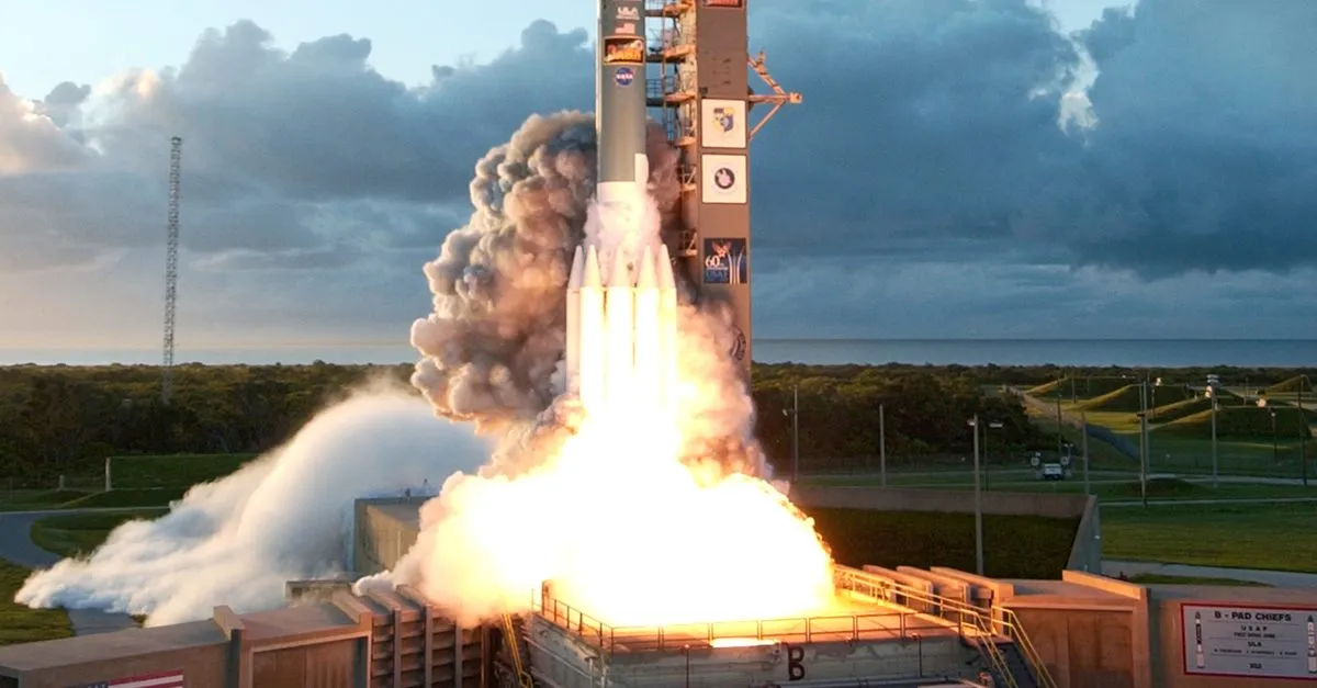
The history of the Global Positioning System (GPS) is abaout signals. Each satellite block added: L2C in 2005, L5 in 2010, L1C in 2018. Three of those four civil signals are still not declared operational in 2026.
Global Positioning System history divides into three eras. The architecture era ended in December 1973, when the Department of Defense (DoD) approved a passive one-way ranging system of 24 satellites in Medium Earth Orbit (MEO). The deployment era ran from the first Block I launch in 1978 to full operational capability in 1995. The modernization era started with Block IIR-M in 2005 and is still running. The dependency underneath all three is the ground segment, which in April 2026 lost the program that was supposed to modernize it.
The frozen architecture in 1973
Three programs converged into GPS, and each contributed a piece that survives in every receiver shipping today.
The conceptual origin is Sputnik. In 1957, scientists at the Johns Hopkins Applied Physics Laboratory tracked the satellite by the Doppler shift in its radio signal and inverted the problem: if you can locate a satellite from a known ground position, you can locate an unknown ground position from a known satellite. The Advanced Research Projects Agency turned that into Transit from 1958. According to the Aerospace Corporation, the first Transit satellite launched in 1960, a 36-satellite constellation was fully operational by 1968, and the system ran 28 years until 1996, delivering accuracy in the tens of metres with long fix times and no altitude solution.
The Naval Research Laboratory’s Timation line moved precise time into orbit, with Timation 1 and 2 flying crystal oscillators in 1967 and 1968 and Timation III in 1974 carrying the first atomic clock on a navigation satellite. The Air Force’s 621B, from a 1963 Aerospace Corporation study led by Phillip Diamond, worked on pseudorandom noise ranging and continuous three-dimensional coverage.
The single most consequential result came from a 1966 Aerospace study by James Woodford and Hideyoshi Nakamura: solve for four satellites instead of three, treat the receiver clock offset as a fourth unknown, and the receiver no longer needs a high-accuracy clock of its own. That is the reason a GPS chip costs a couple of dollars instead of carrying a rubidium standard. Every pseudorange solution running today is still that trade.
Colonel Bradford Parkinson took over the program in November 1972 and synthesized the three lines into one. The December 1973 DoD approval fixed the parameters that have not moved since: passive one-way ranging, 24 satellites, medium Earth orbit, roughly a 12-hour period.
A compressed timeline of what followed:
- February 1978: first Block I developmental satellite launched; three more followed within the year.
- 1983: after the KAL 007 shootdown, President Reagan committed GPS to civil use.
- 14 February 1989: Navstar II-1, the first operational Block II satellite, launched on the first flight of the Delta II.
- 1993 to 1995: the 24-satellite constellation reaches initial and then full operational capability.
- May 2000: Selective Availability (SA) switched off, improving civil accuracy roughly tenfold, per GPS.gov.
- September 2005: Block IIR-M begins broadcasting L2C and the military M-code.
- May 2010: the first Block IIF satellite begins broadcasting L5.
- April 2014: CNAV messages begin broadcasting on L2C.
- December 2018: the first GPS III satellite begins broadcasting L1C.
- April 2026: the Space Force terminates the next-generation ground control program.
What each GPS satellite block actually added
The blocks are not marketing generations. Each one is a distinct bus with a distinct payload capability, and the capability only becomes usable when enough of that block is on orbit.
| Block | Launched | Design life | What it added |
|---|---|---|---|
| I | 1978 to 1985 (11 satellites) | 4.5 years | Concept validation; L1 and L2 with Coarse/Acquisition (C/A) and Precise (P) codes |
| II / IIA | 1989 to 1997 (28 satellites) | 7.5 years | The operational constellation; Selective Availability and Anti-Spoofing |
| IIR | 1997 to 2004 | 10 years | Rubidium clocks, onboard autonomous navigation, improved reliability |
| IIR-M | 2005 to 2009 (8 satellites) | 10 years | L2C, the second civil signal, plus the M-code military signal |
| IIF | 2010 to 2016 | 12 years | L5, the third civil signal, in a protected aeronautical band |
| III | from December 2018 | 15 years | L1C, the fourth civil signal, full M-code capability, higher signal power |
| IIIF | in development | 15 years | Regional military protection, search and rescue payload, laser retroreflector |
Launch dates, counts and design lives follow the European Space Agency’s (ESA) Navipedia GPS space segment page and GPS.gov. Two things fall out of the table. Design life roughly tripled from Block I to Block III, which is good for constellation economics and bad for modernization pace: a 15-year design life means a signal decision made today is still flying in 2041. And every civil signal after C/A arrived on a new block.
Selective Availability and the workaround for civil users
Selective Availability was deliberate degradation of the civil signal, switched off in May 2000, with civil accuracy improving by roughly an order of magnitude according to GPS.gov.
The constraint that shaped receiver design for longer was that until 2005 there was exactly one civil signal. A civil user who wanted dual-frequency measurements, and therefore an ionosphere-free combination, had to track the encrypted P(Y) code on L2 without knowing it. Semi-codeless techniques (signal squaring, cross-correlation, Z-tracking) recover a usable L2 observable by exploiting the structure of the encryption rather than the code itself, and they pay for it in signal-to-noise. Representative figures quoted in the literature run from roughly 13 dB for the better cross-correlation methods to about 30 dB for plain squaring. In practice that meant larger antennas, longer integration times, poor performance under canopy, and an L2 observable that dropped out first under interference.
L2C ended that for civil users. Its two components, a moderate-length code (L2 CM) and a long code (L2 CL) at 511.5 thousand chips per second, are published and trackable directly, and the dataless CL component supports long coherent integration. L5 went further: two quadrature carriers at 10.23 million chips per second in the protected aeronautical radionavigation band, wider bandwidth for sharper code tracking and better multipath rejection, and a dataless pilot component.
The ground segment and a $6.27 billion hole
The monitoring capability that would flip L5’s health bit does not fly on the satellites. It lives in the ground segment, and the ground segment is the part of global positioning system history that has aged worst.
The constellation is still flown by the Architecture Evolution Plan (AEP), the legacy control system. Its replacement, the Next Generation Operational Control System (OCX), was terminated by the US Space Force on 17 April 2026 after roughly 15 years and about $6.27 billion, according to Inside GNSS. Colonel Stephen Hobbs attributed the decision to system issues that emerged during integrated testing of OCX with the wider GPS enterprise, and acting service acquisition executive Tom Ainsworth framed the successor approach as incremental capability delivery rather than all-or-nothing development. AEP continues to fly the fleet with incremental upgrades.
OCX was the vehicle for the monitoring and command capability behind operational declarations for the modernized civil signals and for full M-code operations. M-code itself has received operational acceptance for early use, with GPS World reporting 21 M-code-capable satellites in the operational constellation. Everything past that early-use step now depends on a successor program that has not been defined.
Frequently asked questions
When was GPS invented and who invented it?
GPS has no single inventor. It synthesized three programs: the Navy’s Transit and Timation, which contributed satellite ranging and atomic clocks in orbit, and the Air Force’s 621B, which contributed pseudorandom noise ranging. Ivan Getting, Roger Easton and Bradford Parkinson are the names most often credited. Parkinson took over the program in November 1972, and the Department of Defense approved the architecture in December 1973.
When did GPS become fully operational?
The first Block I developmental satellite launched in February 1978, and the first operational Block II satellite launched on 14 February 1989. The 24-satellite constellation reached initial operational capability in December 1993 and full operational capability in 1995, roughly 22 years after the architecture was approved. GPS.gov commits to at least 24 operational satellites 95% of the time.
What is Selective Availability and why was it turned off?
Selective Availability was the deliberate degradation of the civil GPS signal, applied so that adversaries could not use full accuracy. It was deactivated in May 2000, improving civil accuracy roughly tenfold according to GPS.gov, from around 100 metres to around 10 metres. By then differential techniques had made the degradation easy to defeat, and civil economic value made keeping it hard to justify.
What are the GPS satellite blocks?
The blocks are hardware generations: Block I (1978 to 1985) for validation, Block II and IIA (1989 to 1997) for the first operational constellation, Block IIR (1997 to 2004) with rubidium clocks and onboard autonomous navigation, Block IIR-M (2005 to 2009) adding L2C and M-code, Block IIF (2010 to 2016) adding L5, and GPS III (from December 2018) adding L1C, higher power and full M-code capability.
Why is the GPS L5 signal still marked unhealthy?
Because GPS.gov classifies L5 as pre-operational, with its message set set unhealthy until sufficient monitoring capability is established. The flag reflects the absence of a committed service guarantee, not a defect in the signal. Positioning receivers commonly use L5 regardless and benefit from it; receivers making integrity or certification claims cannot rely on a signal the provider has not committed to.
Sources and further reading
- GPS.gov: New Civil Signals status summary
- GPS.gov: Space Segment
- GPS.gov: GPS Modernization
- US Coast Guard Navigation Center: GPS constellation status
- ESA Navipedia: GPS Signal Plan
- ESA Navipedia: GPS Space Segment
- The Aerospace Corporation: A Brief History of GPS
- NASA: Global Positioning System History
- Inside GNSS: Space Force terminates the GPS next-generation ground control program
- GPS World: GPS military code receives operational acceptance for early use