The future of satellite navigation is not one better GPS (Global Positioning System). It is a layered, resilient stack: slowly modernizing government constellations in Medium Earth Orbit, a fast-arriving commercial layer in Low Earth Orbit (LEO-PNT), and signals of opportunity as a backup. The driver is not accuracy, which is already excellent, but resilience against a sharp rise in jamming and spoofing.
Key takeaways:
- Government GNSS (Global Navigation Satellite System) modernizes on a decade cadence. GPS III and IIIF, Galileo Second Generation and BeiDou’s next phase are real upgrades, but they arrive slowly, which is exactly the gap commercial players are moving into.
- LEO-PNT is the fast layer. Satellites roughly 20 times closer than Medium Earth Orbit deliver far stronger signals and faster convergence. ESA’s Celeste demonstrator and commercial constellations like Xona are flying now.
- Signals of opportunity are a credible backup. Researchers have navigated using Doppler from Starlink, OneWeb and Iridium with no prior knowledge of those downlinks, turning broadband megaconstellations into a rough Positioning, Navigation and Timing (PNT) fallback.
- Resilience is the real driver. Aviation bodies report GNSS interference rising steeply, and the US position is that no single system can back up GPS, so the answer is diversity, not a single replacement.
- The future is multi-layer, not winner-take-all. Expect receivers and services that fuse government MEO, commercial LEO and terrestrial or opportunistic sources into one resilient solution.
For anyone building navigation-dependent systems, the shift is architectural. The question is moving from “which GNSS” to “how many independent layers,” and that reframes what a receiver, a correction service, and a resilience plan need to look like.
The government layer is modernizing, slowly
The four global systems are all mid-upgrade. GPS turned off Selective Availability in May 2000, improving civilian accuracy roughly tenfold, and has since added civil signals L2C and L5 and, on the GPS III satellites, the Galileo-interoperable L1C, per ESA Navipedia. GPS III carries a 15-year design life; the follow-on GPS IIIF adds a Search and Rescue (SAR) payload, a laser retro-reflector array, and regional protection features.
The catch is cadence. Military M-code reached initial operational capability around FY2025 and L5 is not slated for full operational capability until roughly FY2028, according to CAST Navigation, so meaningful government upgrades land on a decade timescale. Galileo Second Generation, with its reconfigurable digital payload and inter-satellite links, arrives later this decade. BeiDou is planning a next-generation system for completion by 2035, and GLONASS is transitioning from frequency-division to code-division signals. All genuine progress, all slow. That slowness is the opening.
The commercial layer is arriving fast: LEO-PNT
The most significant change is not a better satellite in Medium Earth Orbit (MEO); it is moving navigation payloads much closer to the ground.
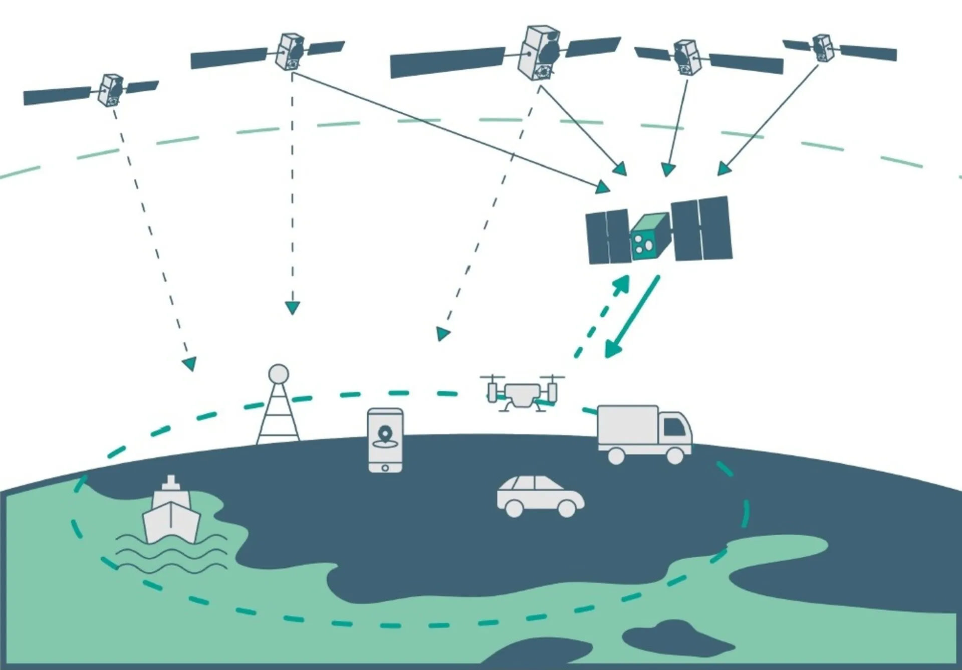
The physics is simple and compelling. A satellite in Low Earth Orbit is roughly 20 times closer than a MEO GNSS satellite, so its signal arrives far stronger, which is precisely what jamming resistance and indoor or urban reception need. More satellites sweeping overhead faster also means quicker convergence for precise positioning. The European Space Agency states plainly that LEO offers “more robust signals” than today’s MEO-based Galileo and describes LEO-PNT as a complementary low-Earth-orbit layer that improves availability in urban canyons and polar regions and makes European navigation more resilient.
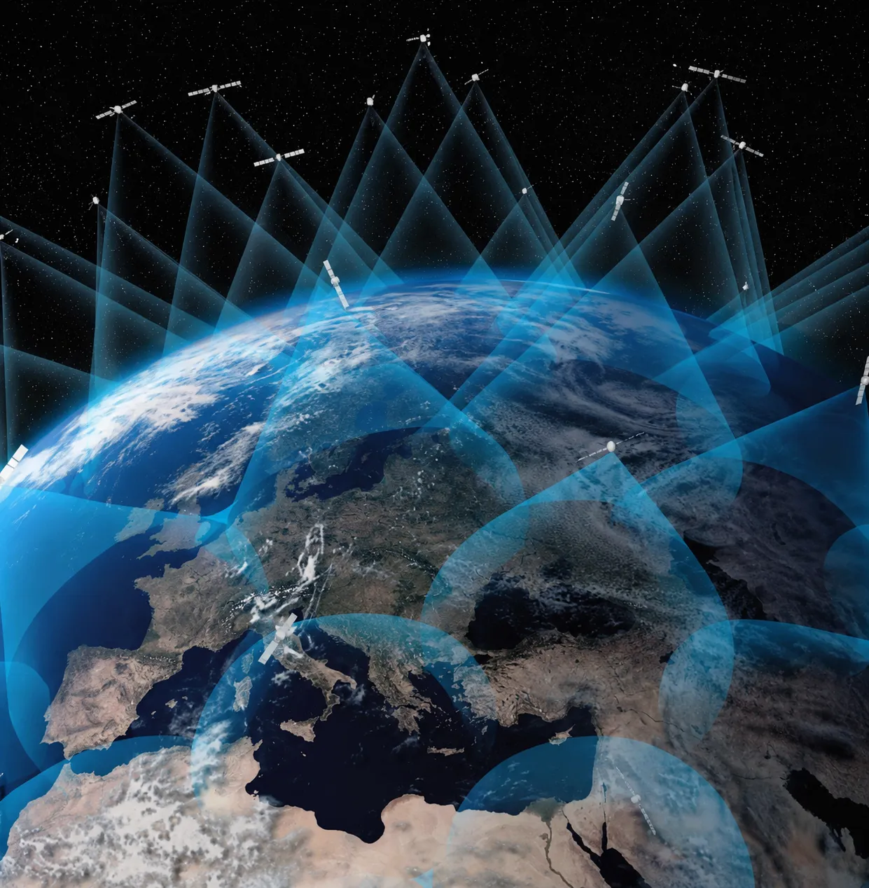
 Moving navigation payloads to low Earth orbit trades constant global coverage for far stronger signals and faster convergence. Photo by ESA.
This is no longer theoretical. ESA’s Celeste programme, part of its FutureNAV initiative, is an 11-satellite in-orbit demonstration; its first two satellites launched on 28 March 2026 on a Rocket Lab Electron, built by GMV and Thales Alenia Space, broadcasting in L-band and S-band, with more to follow in 2027. On the commercial side, Xona Space Systems launched its first production-class satellite, Pulsar-0, on 1 July 2025, and claims a received signal around 100 times stronger than legacy GPS, positioning better than 10 cm, and built-in range authentication to resist spoofing. Treat vendor performance claims as claims until independently verified, but the direction is clear. Commercial LEO players iterate on a cadence of months, not the decade the government systems run on, which is why the fast layer is coming from the private sector.
Signals of opportunity: navigation without a navigation satellite
There is a third, stranger layer: using signals never meant for navigation. Broadband megaconstellations such as Starlink, OneWeb and Iridium blanket the sky with strong downlinks, and their Doppler shift alone carries position information.
The results are real. Researchers at Ohio State University, reporting via Inside GNSS, achieved around 5.1 m two-dimensional positioning while stationary and 9.5 m three-dimensional root-mean-square error on a moving vehicle, using Doppler from Starlink, OneWeb, Orbcomm and Iridium with no prior knowledge of the downlink signals. That is not survey precision, but as a GNSS backup in a jammed or denied environment, metre-to-ten-metre positioning from signals an adversary cannot easily switch off is a meaningful floor. Signals of opportunity turn infrastructure that already exists into resilience you do not have to launch.
Why now: resilience, not accuracy, is the driver
Standalone accuracy is already excellent and converging across systems, so it is not what is pushing the field. Interference is.
Aviation bodies have flagged a steep rise in GNSS disruption: the International Air Transport Association (IATA), drawing on European Union Aviation Safety Agency (EASA) data, reported that GPS signal-loss events rose by 220% between 2021 and 2024, concentrated along specific conflict-adjacent regions, and framed the task as building resilience rather than merely containing interference. The policy conclusion is already on record. The US Department of Transportation’s 2021 Complementary PNT demonstration tested eleven candidate technologies and concluded that none alone can universally back up GPS, and that the best strategy is to pursue multiple technologies for diversity.
That is the thesis in one line: PNT is critical infrastructure, and critical infrastructure gets made resilient by layering independent sources, not by trusting one. A diverse ecosystem, government MEO plus commercial LEO plus opportunistic and terrestrial sources, plus a healthy set of correction and integrity providers, is the resilient answer.
What the future of satellite navigation asks of builders
For engineers and service builders, the practical consequences follow from the layering.
Receivers will fuse more than one PNT layer, so raw-measurement access and multi-source integrity monitoring become baseline requirements, not high-end extras. More capability will arrive as data, correction streams, authentication, and integrity information, delivered over standard protocols rather than baked into a chip. That is the same shape as the correction-service ecosystem already forming around Galileo’s High Accuracy Service, and it is where a neutral, standards-based distribution layer, the kind openRECEIVER is building, fits: many providers and layers reaching many applications without a bespoke integration each time. The winners will be the systems that treat navigation as a portfolio of independent sources to blend, and design for the day the primary one is unavailable.
Frequently asked questions
What will replace GPS in the future?
Nothing will replace GPS outright; the future is layering rather than replacement. GPS and the other government constellations keep modernizing, while commercial LEO-PNT constellations and signals of opportunity add independent layers on top. The US Department of Transportation concluded that no single technology can universally back up GPS, so the resilient answer is a diverse, multi-layer PNT ecosystem.
What is LEO-PNT and how is it different from GPS?
LEO-PNT provides positioning, navigation and timing from Low Earth Orbit, roughly 20 times closer than the Medium Earth Orbit that GPS and Galileo use. That proximity gives much stronger signals, better jamming resistance, and faster convergence for precise positioning, at the cost of needing many more satellites for continuous global coverage. It is designed to complement, not replace, existing GNSS.
Is LEO-PNT better than GPS?
It is better at some things and not a substitute. LEO signals are far stronger, which helps in cities, indoors and against jamming, and they can converge faster. But GPS offers mature, free, global coverage that early LEO-PNT constellations are still building toward. The intended model is complementary: LEO-PNT as a resilient layer on top of GPS and Galileo.
Can GPS be jammed or spoofed, and what is the backup?
Yes. GNSS signals are weak and can be jammed or spoofed, and aviation bodies report sharp increases in interference. Backups being pursued include signal authentication such as Galileo OSNMA, stronger LEO-PNT signals, signals-of-opportunity navigation using broadband constellations, and inertial or terrestrial systems. The consensus is diversity across independent layers rather than a single backup.
What is signals-of-opportunity navigation?
Signals of opportunity (SoOP) means navigating with radio signals not designed for positioning, such as the downlinks from Starlink, OneWeb or Iridium. A receiver exploits properties like Doppler shift to estimate position without those systems cooperating. Demonstrated accuracy is metre-to-ten-metre level, useful as a GNSS backup in denied environments rather than as a precision replacement.
When will Galileo Second Generation and GPS IIIF launch?
Both are later-this-decade programmes. Galileo Second Generation satellites, with reconfigurable payloads and inter-satellite links, are expected to begin deployment around 2027. GPS IIIF is in production as a follow-on to GPS III. As with all launch programmes, published dates shift, so confirm against ESA, EUSPA and US Space Force sources for current schedules.
Sources and further reading
- ESA: Celeste’s first satellites launched to explore LEO-based navigation
- ESA Navipedia: GPS future and evolutions
- US DOT: Complementary PNT and GPS backup technologies demonstration
- IATA: building resilience to GNSS interference
- Inside GNSS: navigation with multi-constellation LEO signals of opportunity
Programme status, launch dates and interference figures are current as of mid-2026 and change over time; confirm against the primary sources before relying on any figure.